RVR
🔹🔹Runway Visual Range
⭕️Runway Visual Range (RVR) is a crucial concept in aviation, especially during low-visibility operations like fog, rain, or snow. Here’s a clear explanation:
🔹🔹Runway Visual Range (RVR)
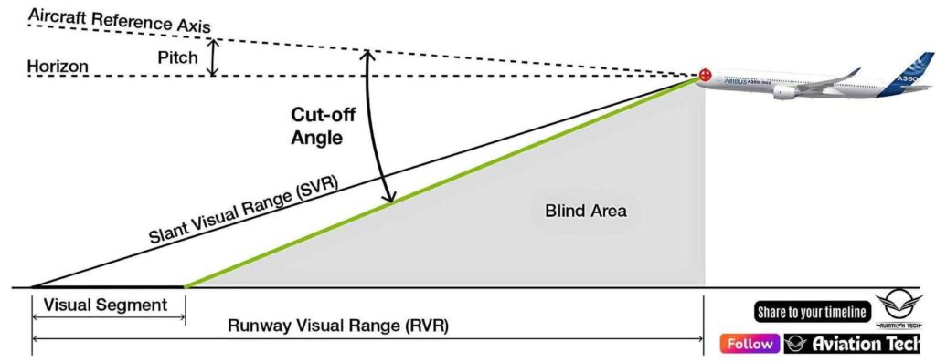
Runway Visual Range (RVR) refers to the distance a pilot can see down the runway from a specified point, usually measured from the approach end, touchdown zone, or midpoint of the runway. It is expressed in meters or feet, depending on the region.
🔹🔹 Why RVR Matters
RVR is critical for takeoff and landing decisions, especially in poor visibility. When visibility drops below standard minima, RVR becomes the primary reference for determining whether an aircraft can safely land or take off.
🔹🔹Key Points:
- Measured by sensors (transmissometers or forward scatter meters) located along the runway.
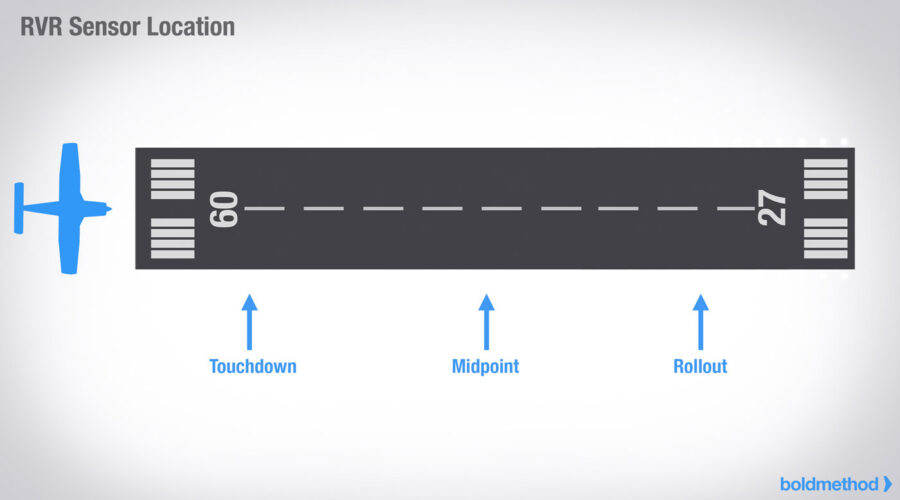
- Given in three segments: Touchdown RVR, Midpoint RVR, and Rollout RVR.
- Reported in METARs (weather reports) and updated in real-time.
- For example:
R27L/550/450/400means RVR on Runway 27L is 550m at touchdown, 450m at midpoint, and 400m at rollout. - Used by pilots to comply with Category I, II, or III approach minima in instrument landing systems (ILS).
🔹🔹Example RVR Values (for reference):
- CAT I ILS – Minimum RVR: ~550 meters
- CAT II ILS – Minimum RVR: ~300 meters
- CAT IIIa ILS – Minimum RVR: ~200 meters
- CAT IIIb ILS – Minimum RVR: ~75–150 meters
- CAT IIIc ILS – No RVR required (not yet operational anywhere)
🔹🔹In Summary:
RVR gives a precise measurement of how far down the runway a pilot can see under current conditions, and is a key factor in ensuring safe takeoffs and landings in low visibility.